HSAT (Heimdal Satellite Technologies): satellite field mapping with machine learning
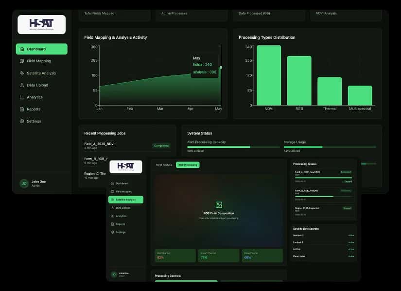
ScalaCode built a web application for Heimdal Satellite Technologies (HSAT) for satellite image processing and field mapping. It converts raw CSV location data into field polygons, produces NDVI and RGB imagery from Sentinel-2, Landsat 8, MODIS and Planet Labs imagery, and runs machine learning models on that imagery to support decisions in agriculture and land management.
Satellite data for agriculture and land management
Heimdal Satellite Technologies (HSAT) works with satellite imagery to support decisions in agriculture and land management. The team needed a web application that takes raw location data, maps it to fields, and processes and analyses satellite images of those fields in large volumes.
What the satellite platform had to handle
Large volumes of satellite data
Satellite imagery comes in large files, and the platform had to store and process a high volume of it.
CSV data to accurate field polygons
Raw location data arrived as complex CSV files that had to be converted into accurate field boundaries.
NDVI and RGB image processing
The app needed image processing that generates NDVI vegetation indices, RGB colour imagery and thermal analysis from satellite data.
Several satellite sources
Imagery from Sentinel-2, Landsat 8, MODIS and Planet Labs had to come into the same workflow as the field data.

Python on AWS, with machine learning on satellite imagery
We built the HSAT web application in Python on AWS, with field mapping, satellite image processing and machine learning analysis in one workflow.
- 01
Automated CSV to field polygon conversion
Users upload CSV location data, and the app converts it into structured field polygons ready for mapping.
- 02
Satellite imagery from four sources
The application retrieves imagery for the mapped fields from Sentinel-2, Landsat 8, MODIS and Planet Labs.
- 03
NDVI, RGB and thermal processing
Python processing generates NDVI vegetation indices, RGB colour imagery and thermal analysis, giving a detailed view of each field.
- 04
Machine learning analysis
Machine learning models analyse the processed satellite imagery to inform agriculture and land management decisions.
- 05
GeoJSON output
Field polygons and results are delivered as GeoJSON for precise field mapping and spatial data representation.
- 06
AWS processing at scale
AWS hosts the application and runs data processing at scale as the volume of satellite data grows.
Field mapping and satellite image analysis in one web app
The HSAT app turns raw CSV location data into mapped field polygons, processes satellite imagery into NDVI, RGB and thermal outputs, and analyses it with machine learning models. The results support decisions in agriculture and land management, on AWS infrastructure sized for large data volumes.
field polygons from raw CSV data
satellite image processing
What Heimdal Satellite Technologies runs on
Python, NDVI, RGB and thermal image processing
AWS
GeoJSON field polygons, Sentinel-2, Landsat 8, MODIS, Planet Labs
Machine learning models for satellite image analysis
Plan a build like Heimdal Satellite Technologies for your business
- 30 minutes with the ScalaCode team
- What is realistic, what it costs and how long it takes
- You decide afterwards whether to build with us